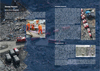
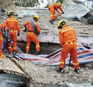
The initial, frenetic disaster-response phase is often followed by a longer, more methodical recovery process involving the deployment of temporary humanitarian aid and logistics support while a more permanent recovery is organised and implemented. The complete disruption or severe degradation of local information sources can hamper the effective deployment and management of temporary aid and infrastructure. Satellites can provide imagery that plays a critical role in rapidly identifying newly formed hazards resulting from the disaster, supplementing and updating national and local geospatial information, and objective monitoring of the effectiveness of humanitarian efforts.
Post-Disaster Assessment
Active wildfires present a clear and direct danger to people, wildlife, property, and infrastructure – but beyond their immediate impact, they have significant long-term impacts on forests that need to be assessed and managed as a part of the recovery process. These impacts include damage to often remote infrastructure like forest roads and bridges, stress induced on delicate ecosystems, updates to forest inventories used by industry, and impacts on the risk profile for future fires. Satellites play a valuable role by enabling the collection of burn-scar imagery in the immediate aftermath of the fire, which can be used to prioritise urgent recovery steps. By their nature, satellites provide systematic revisit over the burnt areas in the months and years following the incident, which allows for an on-going assessment of the recovery of forests and monitoring as the risk of future fires builds with regrowth. This is of particular value in remote forested areas that are not easily accessible to forest managers and national authorities.
Like wildfires, floods also present a clear and direct danger as the waters rise, with most flooding taking place over coastal or low-lying land. Once the danger begins to recede, a rapid assessment of damage is required in order to initiate and direct recovery. This assessment is usually made on site, but in the aftermath of a major flood, damage in the field can pose risks to investigators and often the scale and vastness of the flooded areas would require too many human and material resources to allow for a timely assessment. Satellite imagery provides a viable alternative for a fast and large-scale survey of the flooded region. Archived pre-flood imagery can be used in combination with new acquisitions, enabling recovery managers to rapidly access the scope of inundation. These early assessments can be used to position recovery aid, identify safe and unsafe areas, prioritise infrastructure repair, and monitor risks from repeat flooding.
Monitoring Recovery
As the recovery process proceeds, satellites can provide practical and systematic measures of progress. For example, in the case of recovery from major storms, storm surge, or tsunamis, high-resolution satellite images can be used to determine the condition of individual buildings. When collected at regular intervals, these images can be used to generate a spatially explicit timeline of the recovery and inform the direction of reconstruction aid. In some cases, ocean surges can completely denude coastal settlements of all structures, and so pre-disaster images combined with progressive post-incident images can enable authorities to rapidly and objectively assess recovery.
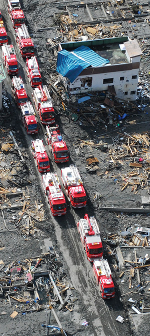
In the case of the January 2010 Haitian earthquake, civil authorities lacked adequate maps of Port-au-Prince, which sustained heavy damage and frequent aftershocks. As a part of the response process, high-resolution satellite imagery was utilised by groups like the Humanitarian OpenStreetMap Team (HOT) to create new pre- and post-incident maps. These satellite-derived maps helped guide first responders and also provided a practical geospatial framework to be utilized by the Government of Haiti during the long recovery process.