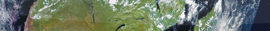
ceos   eesa
CEOS EO HANDBOOK –
EARTH OBSERVATION SATELLITE CAPABILITIES AND PLANS
Capabilities of Earth Observation Satellites
   
Atmospheric Chemistry Instruments
Atmospheric Temperature and Humidity Sounders
Cloud Profile and Rain Radars
Earth Radiation Budget Radiometers
High Resolution Optical Imagers
Imaging Multi-Spectral Radiometers (vis/IR)
Imaging Multi-Spectral Radiometers (Passive Microwave)
Imaging Microwave Radars
Lidars
Multiple Direction/ Polarisation Instruments
Ocean Colour Instruments
Radar Altimeters
Scatterometers
Gravity, Magnetic Field and Geodynamic instruments
  Earth Observation Plans by Measurement  
Catalogue of Satellite Missions
Catalogue of Satellite Instruments


OCEAN COLOUR INSTRUMENTS
Description
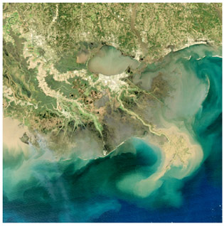
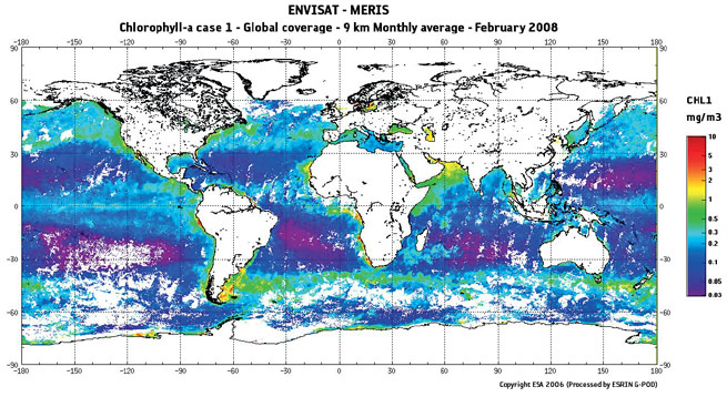
Ocean colour radiometers and imaging spectrometers measure the radiance leaving marine waters in the visible and near IR spectrum in the range 400–800 nm, where the colour is characterised by the constituents of the water – typically phytoplankton, suspended particulate material and dissolved compounds. Differences in the intensity of light received in the different bands give information on the concentration of a variety of substances present in the ocean.

These instruments have very narrow detection channels, around 10 nm wide, to measure fine spectral details. The spatial resolution of these instruments is typically 0.3 to 1 km. The more recent ocean colour instruments have improved spatial, spectral and radiometric resolution. The trend towards multi-channel, multi-purpose sensors, such as MODIS and MERIS, is resulting in more instruments with an ‘ocean colour’ capability.

Significant calibration and validation activities, together with algorithm development for ocean colour instruments, continues – particularly with respect to measuring ocean productivity

MODIS view of Mississippi river delta in February 2008 showing flows of sediments and nutrients.
Applications
The colour of the oceans as seen from space reveals phytoplankton pigment concentration (chlorophyll), which is used as an indirect measurement of ocean biomass and its associated productivity. These parameters are of considerable oceanographic and climatological significance, since oceanic productivity ‘drives’ the air-to-sea exchange of biogenic greenhouse gases (e.g. CO2).

Ocean colour imagery can also be used in support of fisheries management or protection, for example through identification of biologically-rich areas. Other data that may be inferred from ocean colour measurements include information about suspended matter (useful in coastal studies), biological productivity, marine pollution and water dynamics (eddies, currents, etc.) in coastal zones.

Current and planned Instruments
Advanced GOCI OCM (OCEANSAT-3/3A)
CZS OCS
GOCI OES
MERIS OLCI
MODIS SGLI
Multi-band UV/VIS Spectrometer (ACE) VIIRS
OCM  
Global ocean chlorophyll measurements derived from MERIS.
Further Information
MERIS: envisat.esa.int/instruments/meris
MODIS: modis.gsfc.nasa.gov
Ocean colour sensors: www.ioccg.org/sensors_ioccg.html
VIIRS: www.ipo.noaa.gov/Technology/viirs_summary.html


©Copyright 2011 CEOS Print CopiesResearched and written by SymbiosDesigned and built by Beaucroft