It is a stated objective for the Rio+20 Summit to try to assess progress in implementing goals set in 1992 and again in 2002, including the progress achieved by the major conventions. Analysis prepared for Rio+20 suggests that goal-setting in relation to the environment has worked most effectively when clear quantitative targets have been identified. The Montreal Protocol on Substances that Deplete the Ozone Layer defined specific timeframes for the achievement of mandatory targets, and includes reviews of phase-outs supported by scientific updates. It is seen as a model of efficiency for international environmental agreements. Not all agreements are framed with quantitative targets and evidence-based reporting in mind, and the targets may read more like recommendations.
The availability of baseline information for important indicators has been shown to be a practical necessity when attempting to track progress towards agreed targets – such as that adopted by The World Summit on Sustainable Development in 2002 “to reverse the loss of biodiversity by 2010”. The lack of quantitative, baseline data on biodiversity makes it impossible to demonstrate evidence of progress in real terms.
The United Nations Environment Programme has observed that numeric and time-bound targets have aided in the progress made towards the Millennium Development Goals (MDGs), for example, and should be applied towards our environmental objectives as well. A healthy cynicism can be detected in our well-connected 21st century societies with regard to environmental commitments that are not evidence-based, monitored independently or verified for compliance. The underlying data must be an integral part of the process and of proven quality. Quantitative targets can be assumed to be the socially acceptable standard for new environmental agreements, with realistic plans for the establishment of baseline data and for routine monitoring.
Earth observation data and derived information have proven to be essential to the development of the necessary evidence, and of our improved understanding of the Earth System. Earth observations provide the evidence necessary for informed decision-making – supporting the science that underpins strategies for global environmental decision-making – and for monitoring our progress on all geographical scales as we explore new development paths aimed at sustainable management of the planet.
Earth observations are important for our future decision-making processes at every stage of the coordinated action being pursued through the Rio Summit process:
− evidence: Earth observations support the formulation of authoritative scientific advice. Evidence is vital for governments when deciding whether to fund mitigation measures, how to react to impending crises in resource shortages, or whether to participate in agreements or conventions that require costly changes in national consumption patterns;
− baselines: establishing baseline information against which ongoing changes can be measured, such as greenhouse gas emissions or national forest inventories;
− monitoring and compliance: we can expect to see increasing emphasis on international policy measures and treaties emerge in future. Earth observations will form an essential role in supporting such agreements by verifying countries’ fulfilment of their treaty obligations. The economic implications of such agreements can be enormous for countries, so highly visible and public measures to ensure compliance will be an important part of their success. Satellite data will be fundamental in developing the routine reporting required to monitor progress on all scales: nationally, in support of government reports to the major conventions and globally so that key indicators can be derived and tracked. Earth observation satellite data contribute to the creation of common databases and reporting procedures among different conventions;
− assessing progress and improving understanding: assessing the effectiveness of policy measures towards the key environmental indicators and improving research into Earth System processes and their various interactions, thereby supporting decision-making as to necessary coordinated actions;
− improved predictions: global and regional observations over recent decades are essential to identify environmental and climatic changes and to test and validate predictions that are fundamental to supporting adaptation planning;
− management and mitigation: to support increased efficiency in basic resource provision for future generations while predicting and countering the worst effects of severe weather and natural disasters.
Better information on the basic activities that support human existence will be a vital component of the global strategy for day-to-day adaptation to a world with a rapidly growing population, depleting natural resources, and short-term consequences of human-induced environmental and climatic change. Regions, countries and industries can all be expected to strive for improved efficiency and international competitiveness in agricultural production, freshwater management, land use management, atmospheric emissions control and natural resources exploration and management – including forests and fossil fuels. They will also need to improve the prediction and mitigation of frequent extreme weather events and natural disasters.
Earth observation information will be required on all scales – from local to global. We can anticipate that it might be used by national and international authorities for decision-making to ensure sustainability, and also more locally as regions and industries compete for larger shares of smaller reserves of natural resources in order to support their growing populations and economic ambitions. Such information takes many forms, spanning data on population, demographics, economics and environmental indicators. Observations of planet Earth itself, and of human societies’ impact upon it, might be regarded as the most important context for societal decision-making.
The beneficiaries of Earth observations are a broad range of users, including: national, regional and local decision-makers; organisations responsible for the implementation of international conventions and treaties; business, industry and service sectors; scientists and educators; and, ultimately, every inhabitant of planet Earth.
Many of the quantitative indicators that will be discussed at Rio+20 with regards to the progress over the last 20 years will have been derived largely or exclusively from satellite Earth observation data. These data offers many ways to improve the implementation of multilateral environmental agreements, such as the continuous provision of global data, historical data archives, observations of several environmental parameters at global, national and local scales, and the provision of synoptic and comparable information without infringing on national sovereignty.
The importance of satellite Earth observations in the definition and implementation of the UN Framework Convention on Climate Change is an effective illustration of their fundamental role in support of MEAs. The importance of systematic global observation for understanding climate change has always been recognised by the UNFCCC. In 2004, an Implementation Plan for a Global Climate Observing System (GCOS) was defined, which ensures that countries have the observational information needed to understand, predict and manage their response to climate and climate change over the 21st century and beyond. The Plan addresses the commitments of the Parties under Articles 4 and 5 of the UNFCCC and supports their needs for climate observations in fulfilment of the objectives of the Convention. Of the 50 or so Essential Climate Variables specified in the GCOS Implementation Plan, more than half are derived largely or exclusively from satellite observations.
Essential Climate Variables
Domain
Essential Climate Variables
Atmospheric (over land, sea and ice)
Surface: air temperature, wind speed and direction, water vapour, pressure, precipitation, surface radiation budget.
Upper-air: temperature, wind speed and direction, water vapour, cloud properties, Earth radiation budget (including solar irradiance).
Composition: carbon dioxide, methane and other long-lived greenhouse gases, ozone and aerosol – supported by their precursors.
River discharge, water use, groundwater, lakes, snow cover, glaciers and ice caps, ice sheets, permafrost, albedo, land cover (including vegetation type), fraction of absorbed photosynthetically active radiation (FAPAR), leaf area index (LAI), above- ground biomass, soil carbon, fire disturbance, soil moisture.
Measurements of variables in bold type have a significant contribution from satellite observations.
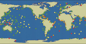
Many more of the main environmental conventions are reliant on satellite observations for one or more fundamental tasks, such as the development of evidence, definition of baselines, monitoring of compliance and assessing progress. Earth observation satellites have proved their capabilities to monitor multiple aspects of the total Earth System on a global basis accurately, unlike ground-based systems, which are limited to land areas and cover only about 30% of the planet’s surface.
Currently, satellite systems monitor the evolution and impact of El Niño, weather phenomena, natural droughts, vegetation cycles, the ozone hole and other important atmospheric composition measurements, solar fluctuations, changes in snow cover, sea ice and ice sheets, sea level rise, ocean surface temperatures and biological activity, coastal zones and algal blooms, deforestation, forest fires, urban development, volcanic activity, tectonic plate motions and more.
These various observations are used extensively in real time decision-making and in the strategic planning and management of industrial, economic and natural resources. The proliferation of Earth observation satellites reflects their unique abilities and benefits, such as:
• wide area observation capability;
• non-intrusive observations, allowing collection of data to take place without compromising national sovereignty;
• uniformity that enables the same sensor to be used at many different places in the world;
• rapid measurement capability, allowing sensors to be targeted at any point on Earth, including remote and inhospitable areas;
• continuity, with single sensors or series of sensors providing long time series of data.