Sea ice cover, edge and thickness
Sea ice modulates planetary heat transport by insulating the ocean from the cold polar atmosphere and by modulating the thermohaline circulation of the world ocean through processes in deep-water. Moreover, the high albedo of ice insulates the polar oceans from solar radiation. Time series of sea-ice concentration data are also critical for identifying inter-annual and decadal fluctuations that could point to the existence of significant changes in oceanic and atmospheric circulation at high latitudes. The motion of sea ice creates patterns of ice convergence and divergence that play a critical role in determining energy and momentum fluxes between the ocean and atmosphere at high latitudes.
Near real-time delivery of data tracking the continually changing nature of ice field conditions provides operational sea ice charts for use by:
- shipping to avoid damage, delay and to reduce fuel costs;
- offshore drilling companies;
- maritime insurance companies;
- government environmental regulatory bodies.
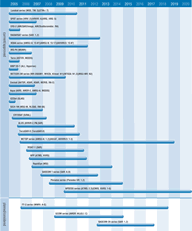
Ice cover and type may be determined using visible/infra-red sensors which are currently available (AVHRR, AATSR etc). Observations provided by microwave instruments on polar satellites also offer good horizontal and temporal resolution and acceptable accuracy. The data now produced are being used to generate wide-area sea ice motion and deformation products for the north polar region and similar products are being planned for the south polar region. Systematic global observation of sea-ice extent and concentration, inferred from passive imaging microwave radiometry, has already produced a 20-year record of global sea ice concentration.
Improved microwave imagery from multi-spectral radiometers such as AMSR (on Terra) provide all weather operation coupled with good coverage.
High resolution synthetic aperture radars such as on Envisat and RADARSAT offer the best source of data, and again have the important advantage of all-weather day/night operation. Data from these instruments provides information on the nature, extent and drift of ice cover and is used not only for status reports, but also for ice forecasting and as an input for meteorological and ice drift models. JAXA’s PALSAR radar will contribute to methodological development of extensive sea ice monitoring and, using polarimetric data, will improve the accuracy of sea ice classification.
Low resolution scatterometer observations are also used to retrieve information on sea ice extent and concentration in all weather conditions, during day or night.
Current radar altimeters provide some information on ice thickness, but more accurate measurements have been provided since the launch of ICESat in 2003 (and are expected from Cryosat from March 2005).
In its January 2001 Report, the IGOS Ocean Team stated that:
- ERS/Envisat offer an Arctic coverage service since 1991;
- RADARSAT has provided SAR coverage of the majority of the Arctic every few days since 1996;
- JAXA’s AMSR-E radiometer on Aqua and operational sensors such as the DMSP SSM/I and NOAA CMIS on NPOESS missions will ensure continuity of the global sea ice concentration in the near term;
- continuation of RADARSAT/Envisat class radar-equipped missions is important in providing complementary high resolution data to further elucidate sea ice processes.

