Liquid water and precipitation rate
Water forms one of the most important constituents of the Earth's atmosphere and is essential for human existence. The global water cycle is at the heart of the Earth’s climate system, and better predictions of its behaviour are needed for monitoring climate variability and change, weather forecasting, and sustainable development of the world’s water resources. A better understanding of the current distribution of precipitation, and of how it might be affected by climate change, is vital in support of accurate predictions of regional drought or flooding.
Information on liquid water and precipitation rate is used for initialising NWP models. For global NWP a variety of satellites provide complete global coverage, but they present two major challenges: firstly, the satellite sensors (such as visible/IR imagers on geostationary weather satellites) typically observe quantities (such as cloud height and cloud top temperature) related to precipitation, and algorithms must be developed to get the best estimates from each particular sensor; and secondly, the mix of available data is constantly changing in space and time.
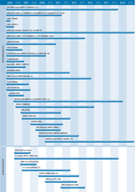
Microwave imagers and sounders (eg AMSR-E) offer information on precipitation of marginal horizontal and temporal resolution, and acceptable to marginal accuracy (though validation is difficult). Satellite-borne rain radars (eg on the recently-ended TRMM mission, and on CloudSat), together with plans for constellations of microwave imagers, offer most potential for improved observations. For regional NWP, no satisfactory precipitation estimates are available from satellites at present, although satellites are the only potential source of information over the oceans. Geostationary satellites do provide vital information on the location of tropical cyclones.
Increasing amounts of useful microwave data - such as from the TRMM mission - are becoming available. TRMM was dedicated to studying tropical and sub-tropical rainfall and carried the first spaceborne precipitation radar, NASDA's PR instrument, and also NASA's TMI microwave imager. Data from PR and TMI have provided new insights into the internal composition of tropical thunderstorms associated with hurricanes. NASA, JAXA and ESA plan to continue this collaboration in future to develop the Global Precipitation Measurement mission (GPM) for launch from 2009; the GPM constellation of satellites will provide global observations of precipitation every three hours to help develop the understanding of the global structure of rainfall and its impact on climate. The recently approved CNES-ISRO mission Megha-Tropiques will provide further measurements of tropical rainfall; MADRAS, a passive multi-frequency radiometer, will collect data on rain over the oceans.
The CMIS microwave imager/sounder on NOAA's NPOESS missions will be sensitive to various forms of water and moisture in the atmosphere and clouds, and will provide an ‘all weather’ measurement capability.
Future coordination of these various satellite programmes, as well as the efforts of the in-situ measurement community, will be addressed by the Integrated Global Water Cycle Observations Theme (IGWCO) of the IGOS Partnership. The first element of IGWCO is a ‘Coordinated Enhanced Observing Period (CEOP)’ which is taking the opportunity of the simultaneous operation of key satellites of Europe, Japan, and USA to generate new data sets of the water cycle.
The IGWCO Theme report is available from www.igospartners.org. This document represents a comprehensive overview of the state-of-the-art in water cycle observations and formulates recommendations for an international work programme to better understand, monitor and predict water processes.

