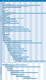
Cloud type, amount and cloud top temperature
The study of clouds, where they occur, and their characteristics, play a key role in the understanding of climate change. Low, thick clouds primarily reflect solar radiation and cool the surface of the Earth. High, thin clouds primarily transmit incoming solar radiation; at the same time they trap some of the outgoing infrared radiation emitted by the Earth and radiate it back downward, thereby warming the surface of the Earth. The Earth's climate system constantly adjusts in a way that tends toward maintaining a balance between the energy that reaches the Earth from the sun and the energy that goes back from Earth back out to space. This process is known as Earth's ‘radiation budget’. The components of the Earth system that are important to the radiation budget are the planet's surface, atmosphere and clouds.
The IPCC point out that even the most advanced climate models cannot yet simulate all aspects of climate, and that there are particular uncertainties associated with clouds and their interaction with radiation and aerosols.
Weather forecasters are able to draw on a range of satellite data on clouds in devising models and in making forecasts. For both global and regional NWP models, satellite instruments offer detailed information on cloud coverage, type, growth and motion. The coverage is global from polar orbiting satellites and - with the exception of high latitudes - global from geostationary satellites. Infrared imagers and sounders can provide information on cloud cover and cloud top height of good horizontal and temporal resolution. Microwave imagers and sounders give information on cloud liquid water, cloud ice and precipitation. Microwave information is valuable for regional mesoscale models which have sophisticated parameterisation of cloud physics. In the context of nowcasting and very short range forecasting, meteorological satellite data are well suited to monitoring the rapid development of precipitation-generating systems in space and time.
In the field of climate research, the MODIS and MISR spectro-radiometers on the Terra mission are enabling viewing of cloud features at higher resolutions than previously. MODIS is taking measurements to allow more precise determination of the contribution which clouds make to the ‘greenhouse’ warming of the Earth. MISR is observing angles at which sunlight is reflected from clouds. These observations are critical in support of new research on the radiative properties of clouds. On the same Terra mission, the ASTER radiometer, measuring visible and infrared wavelengths, will complement the other instruments by providing high resolution views of specific targets of interest.
For weather forecasting, satellite instruments will continue to offer a wealth of useful information on clouds. HIRS, AMSU-A, MHS and IASI on polar orbiting missions will offer improved information on clouds. Geostationary imagers and sounders (on MSG, GOES, Elektro-L, INSAT, MTSAT and FY-3 series) will contribute to retrieval of information about cloud cover, cloud top temperature, cloud top pressure and cloud type, and will be close to meeting regional NWP modeling needs for these variables. Retrievals will not only comprise the temperature and moisture profiles, but also fractional cloud cover, cloud top height, cloud top pressure, surface temperature and surface emissivity - from both infrared and microwave soundings.
The increased use of imager data to determine the cloud amount will improve the performance and the number of retrieved profiles. In general, IASI will increase sounding performance to a level very significant for regional NWP. On the NPOESS series of satellites, parameters that may be derived from VIIRS will include cloud cover.

