Albedo and reflectance
Albedo is the fraction of solar energy that is reflected back from Earth to space. Measurements of albedo are essential for climate research studies and investigations of the Earth’s energy budget. Different parts of the Earth have different albedos. For example, ocean surfaces and rain forests have low albedos, which means that they reflect only a small portion of the sun’s energy. Deserts, ice and clouds, however, have high albedos; they reflect a large portion of the sun’s energy. The high albedo of ice helps to insulate the polar oceans from solar radiation. Over the whole surface of the Earth, about 30% of incoming solar energy is reflected back to space. Because a cloud usually has a higher albedo than the surface beneath it, clouds reflect more shortwave radiation back to space than the surface would in the absence of the cloud, thus leaving less solar energy available to heat the surface and atmosphere. Hence, this ‘cloud albedo forcing’, taken by itself, tends to cause a cooling or ‘negative forcing’ of the Earth’s climate.
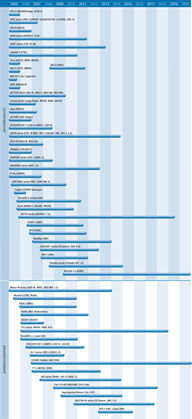
Surface albedo can be estimated from shortwave, broadband or multi-spectral radiometer measurements with good horizontal resolution. Current measurements of albedo and reflectance are obtained primarily using multi-spectral imagers such as AATSR, AVHRR, and sensors on SPOT, Landsat, and some geostationary satellites.
Clouds, aerosols and atmospheric gases affect the accuracy achievable, which is currently marginal to acceptable, but should become good as progress is made in interpreting data from high-resolution, multi-spectral instruments. Surface conditions (moisture, surface vegetation, snow cover etc) strongly affect albedo and high quality ground truth data is necessary in support of satellite measurements. Better understanding of the reflectance properties of different surfaces and more accurate aerosol data (to correct atmospheric effects) is needed to improve surface reflectance measurements.
As aerosol concentration increases within a cloud, more cloud drops form. Since the total amount of condensed water in a cloud does not change much, the average drop becomes smaller. This has two consequences - clouds with smaller drops reflect more sunlight and such clouds last longer. Both effects increase the amount of sunlight that is reflected to space without reaching the surface.
The Terra spacecraft is yielding greater knowledge of such cloud/aerosol effects - with MODIS and MISR providing data on cloud features, and ASTER providing complementary high spatial resolution measurements. Terra’s data will provide new insights into how clouds modulate the atmosphere and surface temperature. Further multi-directional and polarimetric instruments (eg POLDER) should also provide measurements leading to better estimates of albedo.
New sensors, such as GERB and SEVIRI (on the MSG missions, starting with METEOSAT-8), provide improved capabilities for measuring surface albedo; improved sounder performance will yield more information on the infrared surface emissivity spectrum; multi-spectral imaging sensors such as AVHRR/3, VEGETATION, IVISSR and AWIFS will provide global visible, near infrared and infrared imagery of clouds, the ocean surface, land surface, and vegetation.

