The change in sea level is one of the main impacts of anthropogenic – or human-induced – climate change and systematic observations over the long term are essential in assessing impacts and planning potential adaptation. This is particularly true in low-lying areas where rising sea level directly threatens damage to coastal infrastructure, more frequent storm- surge flooding, loss of habitat through wetland inundation and, in some cases, potentially the basic viability of entire small island nations.
Sea level is also essential to climate science, serving as a fundamental parameter in the monitoring and tracking of climate change by providing an observable model output for seasonal, inter-annual and decadal climate prediction. Sea level observations provide scientists with important inputs to the modelling of other parameters such global heat exchange via ocean circulation.
Satellites provide spatially explicit, consistent and comparable global-scale observations. These observations have significantly reduced the uncertainty of both global average and regional sea level records. The comprehensive sea level measurements provided by satellites are essential to addressing the monitoring needs of society, government and the science community.
The Unique Contribution of Satellite Altimetry
For more than 100 years, accurate sea level records have been maintained by coastal and mid-ocean island tidal gauges. These measurements provide valuable data and have helped to establish long-term trends, but are limited by the nature of their measurements and the coverage area over which they are able to provide them.
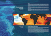
In contrast to the sparse network of tidal gauges, measurements by satellite radar altimetry provide near global and homogenous coverage of the world’s oceans. Tidal gauges continue to provide important in–situ observations, but since the early 1990s, satellite altimetry has become the main tool for precisely and continuously measuring global sea levels. The satellite carries a high accuracy radar altimetry instrument that precisely measures the distance between the spacecraft and the Earth’s surface below. These observations are repeated systematically over thousands of points across the ocean’s surface every few days. They enable monitoring on global, regional, and local scales, allowing for the assessment of trends in relation to factors like tides, changes in temperature and ocean salinity, and surface winds.